What is the GEOFLUV method? - LIFE Tecmine
Back What is the GEOFLUV method?
What is the GEOFLUV method?
The Complutense University of Madrid (UCM) group is working on following actions and sub-actions of TECMINE project:
Action A3. Referent and limitations
Sub-action A4.2. Project design for geomorphological restoration
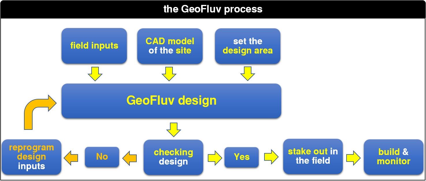
The sub-action A4.2 is focused on the geomorphological reconstruction design of the areas under restoration in the framework of LIFE TECMINE project. In contrast to the conventional and dominant approaches of mining restoration, which remodel the minescapes resulted from mining operations —waste dumps and exploitation highwalls— with morphologies of berms and rectilinear talus (terraced topography), the geomorphological restoration approach of the LIFE TECMINE project will reconstruct natural drainage basins and networks, which will replicate the complexity and functionality of those existing in nature. All this without using materials foreign to the sterile or mining substrates (such as concrete downpipes or breakwater materials). The main objectives are, therefore, to construct stable and functional landscapes, where erosion is controlled by an expert management of the runoff, and the integration of the restored areas in the surroundings. The design is made through a specific software, Natural Regrade. This software uses design parameters (inputs) obtained from natural landscapes.
The identification and analysis of this natural landscapes, considered as referent areas is the objective of the Action A3. Referent and limitations. That is, for this whole process it is necessary to identify references or analogues of natural river basins, developed over time in materials similar to the sterile miners, and in similar climatic conditions. An example of a design parameter is the drainage density, which is the ratio between the length of river courses that drain or cross a surface, and that surface. That is, a value of 90 m/ha means that for each hectare of restored mine it is necessary to design 90 meters of river channels. Another value would be the sinuosity of the fluvial channels, which is the relationship between the length of the channel and the length of the valley. As an example, a sinuosity index of 1.2 means that a 100 m long valley floor is crossed by a river channel that describes meanders, whose total length is 120 meters.
At the present time, the UCM group is working on obtaining such design parameters (inputs) by analyzing orthophotos and geologic maps using ArcGIS software. Once some areas of interest were identified, fieldwork would be carried out to take the necessary measures in the field.

Disclaimer
Disclaimer
The LIFE TECMINE project and this website's content have been funded with the support of the LIFE Programme of the European Union.
*This publication [communication] reflects the views only of the author/s, and the Commission cannot be held responsible for any use which may be made of the information contained therein.


